


Illyrians & Romans
From Illyrian tribes to the Roman province of Praevalitana: Montenegro's foundations
Montenegro does not begin in the Middle Ages. It begins much earlier, with peoples Rome called barbarians — peoples who had built fortifications, minted coins, and assembled a fleet capable of challenging the Mediterranean.
- Period 3rd century BC — 6th century AD
- Key tribes Ardiaei (coast) · Labeates (interior)
- Roman capital Doclea (Podgorica)
- First Illyrian War 229 BC (Queen Teuta)
A country that existed before it had a name
The interior mountains and coastal bays were Illyrian territory centuries before Roman legionaries arrived. The Illyrians left no great texts or marble temples, but they left something more enduring: the territorial logic that still defines Montenegro today. The routes followed by modern roads, the sites where medieval towns would be founded, the relationship between coast and interior as two parallel worlds that need each other without fully understanding one another. All of this was already laid down when Roman legionaries first set foot on this shore of the Adriatic.
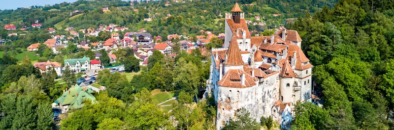
Understanding that deep layer transforms the experience of travelling through the country. The walls of Kotor were not built in a vacuum: they were built where an Illyrian settlement already controlled the entrance to the bay. The ruins of Doclea, on the outskirts of Podgorica, are not a minor archaeological site: they are the urban nucleus that connected this corner of the Balkans to the Roman imperial system. And the very division between a coast open to the world and a mountainous, autonomous interior is an inheritance that predates any modern border.
The Illyrians: a constellation of tribes
Speaking of “the Illyrians” as a single people is a simplification that even the Greeks were guilty of. In reality, the western strip of the Balkans was inhabited by dozens of tribes with related languages but independent political structures. In the territory that is now Montenegro, two of those tribes are particularly significant.
Mastery of the sea
Coast from the Bay of Kotor northward. Dominant naval power in the eastern Adriatic in the 3rd c. BC, with a fleet of fast lemboi and capital at Rhizon (present Risan). Economy between trade and piracy.
Mastery of the land
Lake Skadar basin and the course of the Moraca. Centre near present Podgorica, controlling overland routes between the Adriatic and the Balkan interior. Fishing, alluvial agriculture and northern passes.
The Ardiaei and mastery of the sea
The Ardiaei occupied the coast from the present-day Bay of Kotor northward, and during the third century BC they became the dominant naval power in the eastern Adriatic. They were not simple fishermen who occasionally raided ships: they had an organised military structure, a fleet of light vessels called lemboi — fast, shallow-draught, perfect for coastal waters full of islands and channels — and an economy based on both trade and piracy. The distinction between the two activities was, in the ancient world, considerably more blurred than we like to think.
Their capital was at Rhizon, modern-day Risan, at the innermost point of the Bay of Kotor. If you visit Risan today, you will find a quiet town famous for its Roman mosaics — but the choice of site was not Roman. It was the Ardiaei who understood that the most sheltered point of the most protected bay along the entire coast was the perfect location for a capital: inaccessible by sea unless you controlled the narrow entrance to the bay, and connected by mountain passes to the interior.
The Labeates and the lake
Inland, the Labeates controlled the Lake Skadar basin and the course of the Moraca River. Their centre was near present-day Podgorica, at a point where rivers converge and a relatively fertile plain opens up before the mountains close everything in. The Labeates had no fleet, but they had something equally valuable: control of the overland routes between the Adriatic coast and the Balkan interior.
Lake Skadar, which today you can explore by boat among water lilies and pelicans, was then an economic axis. Fishing, agriculture on the alluvial plains, and control of the passes northward defined the Labeates’ wealth. When you visit the lake and see the small islets with their medieval monasteries, remember that those islets were already strategic points two thousand years before any church was built on them.
Queen Teuta and the clash with Rome
The story of the Illyrians in the Adriatic changes direction with a woman. Teuta assumed the regency of the Ardiaean kingdom around 231 BC, after the death of her husband Agron, and far from limiting her ambitions, she expanded them. Under her rule, Illyrian naval raids intensified to the point of threatening the trade routes that Rome and its Greek allies needed to connect Italy with the eastern Mediterranean.
Rome sent ambassadors. Teuta, according to Roman sources — which are obviously not impartial — received them with contempt. One of the ambassadors was killed. It was exactly the kind of pretext Rome needed, and in 229 BC it launched the first of the Illyrian Wars: a naval and land force that crossed the Adriatic and subdued the coast in a campaign that established the pattern of Roman intervention in the Balkans for the next two centuries.
Teuta and the Coruncanii: the scene that triggered the First Illyrian War
The account comes down to us through Polybius, a Greek historian writing seventy years after the events and with every reason to present Rome as a reasonable victim. According to his version, in the winter of 230-229 BC Rome sent the brothers Gaius and Lucius Coruncanius as ambassadors to Teuta's palace at Scodra to demand an end to Ardiaean raids against Italian merchants. Teuta received them in the middle of a naval campaign against the Greek island of Issa — a campaign which, from the Illyrian perspective, was a purely local affair between Adriatic powers. The Coruncanii laid out the Roman ultimatum. Teuta replied, again according to Polybius, that "it was not the custom of the Illyrian crown to prevent its private subjects from taking the profits of the sea" — a formula so impeccable in its irony that one suspects Polybius embellished it.
Lucius Coruncanius lost his patience and answered the queen with what Polybius calls "frank but ill-timed liberty" — presumably a direct threat. As the ambassadors were returning to Italy by sea, they were intercepted by an Illyrian ship. Lucius was killed; Gaius was captured. The incident, on the Roman reading, was a flagrant breach of the ius gentium. From the Illyrian point of view, it was probably no more than a pragmatic reprisal against someone who had insulted the queen in her own palace. But the chronology of what followed suggests Rome had been looking for a pretext for some time: barely six months after the murder, a fleet of two hundred ships and twenty thousand legionaries was crossing the Adriatic under the consul Gnaeus Fulvius Centumalus.
The war lasted two campaigns. The Ardiaei, unable to resist on open water against so large a fleet, fell back into the interior. Teuta abandoned Scodra and took refuge in Rhizon — modern Risan, at the innermost point of the Bay of Kotor —, the last Illyrian stronghold unreachable from the sea. There she held out for several months, until in 228 BC she signed peace terms: Rome did not annex the territory immediately, but obtained a protectorate over the coastal cities, right of passage for its merchant ships, and an explicit prohibition on the Illyrian fleet sailing south of Lissus (modern Lezhë, in Albania). Teuta lived out her last years at Rhizon as regent of a kingdom reduced to half its original extent. She never again posed a threat. But the precedent was set: any power controlling this coast had to answer to Rome.
Teuta’s defeat was not merely military. It was the moment when the Adriatic ceased to be a shared sea and became a Roman lake. For the traveller, this has a concrete consequence: all the coastal architecture of Montenegro, from the walls of Kotor to the harbours of Budva and Ulcinj, follows a logic of maritime control that Rome imposed and every subsequent civilisation inherited.
The province of Praevalitana
The conquest was not instantaneous. Rome needed almost two centuries — and several more Illyrian wars — to consolidate its control over the entire region. Montenegrin territory was initially incorporated into the province of Illyricum and later into Dalmatia. But the most significant change came with Diocletian’s reforms at the end of the third century AD, when the vast Dalmatian territory was subdivided and the province of Praevalitana emerged, with its capital at Doclea.
Doclea: the city Podgorica has forgotten
Doclea lies barely three kilometres from the centre of Podgorica, at the confluence of the Moraca and Zeta rivers. It is one of the most undervalued archaeological sites in all of Montenegro. It lacks the spectacle of Diocletian’s Palace in Split or the preservation of Butrint in Albania, but what can be seen — the remains of the forum, the baths, fragments of walls, the foundations of an early Christian basilica — is enough to understand that this was a real city, not a frontier outpost.
Doclea had a forum, thermal baths, an aqueduct, and a wall enclosing approximately fifteen hectares. It was the administrative node connecting the coast with routes into the Balkan interior, and its position at the river confluence was no accident: rivers were the motorways of the ancient world, and whoever controlled this junction controlled the traffic between the Adriatic and the heart of the peninsula.
What makes visiting Doclea special is precisely its relative neglect. There are no major restorations or sophisticated interpretation centres. You walk among the ruins with the feeling of discovering something the modern city itself has chosen to ignore. That tension between the Roman past and Podgorica’s urban present is, in itself, a lesson in how the Balkans process their history.
The roads: a skeleton still alive
Rome did not merely conquer: it connected. The network of roads laid across Montenegrin territory is probably the most tangible legacy of the Roman presence, even if it is the least visible. The modern roads between Podgorica and the coast, between Lake Skadar and the mountainous north, follow in many cases the exact alignment of Roman roads. Not out of nostalgia, but because of topography: the Romans identified the most efficient mountain passes, the most navigable river valleys, and those routes remain the only feasible ones.
The main road connected Scodra (modern Shkodra, in Albania) with Narona (in present-day Croatia) along the coast, with branches into the interior through the Moraca and Zeta valleys. When you drive the road climbing from Podgorica into the Moraca canyon — one of the most dramatic experiences in the country — you will be following a route that was already two thousand years old when the Ottomans travelled it.
Diocletian and the fracture of the empire
There is a personal connection between this region and one of the most decisive moments in European history. Diocletian was born in Salona (near modern Split, in Croatia), less than two hundred kilometres northwest of the Bay of Kotor. When in 285 AD he reorganised the empire into the tetrarchy and divided its administration between East and West, Praevalitana found itself on the border between both worlds.
That dividing line was not merely administrative. Over time, it would become the fracture between Latin and Orthodox Christianity, between the Latin and Cyrillic alphabets, between Rome and Constantinople. Montenegro, situated precisely on that line, has lived ever since in a zone of contact — or friction — between two ways of understanding Europe. When you notice that the churches in Kotor are Catholic while those in Cetinje are Orthodox, when you sense that the coast looks toward Italy and the interior toward Serbia, you are seeing the consequences of an administrative decision made in the third century.
The arrival of Christianity
The religious transition was not a sudden event but a process that unfolded across the fourth and fifth centuries. Praevalitana was one of the first regions in the western Balkans to officially adopt Christianity, and the archaeological evidence confirms it.
At Doclea, the foundations of several early Christian basilicas dating to the fifth century have been excavated. In the Bay of Kotor, the earliest churches were built on or beside pre-existing Roman structures — a pattern repeated throughout the Mediterranean that speaks of continuity rather than rupture. The Cathedral of Saint Tryphon in Kotor, although the current building dates from the twelfth century, stands on a site of worship that goes back to the late Roman period.
What is most revealing is what these early churches tell us about the structure of power. They were built at the same points where the Roman state had concentrated its administration: at Doclea, at Risan, at coastal locations where control of the harbours was essential. Christianity did not replace Roman territorial logic; it adopted it and sanctified it.
What remains, what you can see
The traveller who moves through Montenegro with this layer of understanding will discover that the ancient country is not buried beneath the modern one: it is woven into it. The mosaics of Risan — especially the magnificent mosaic of Hypnos, the god of sleep, unique in its iconography across the entire Mediterranean — are the most accessible proof of Roman sophistication on this coast. The ruins of Doclea, free to enter and almost always deserted, offer an archaeological experience without tourist filters. The walls of Kotor, though medieval in their current form, spring from foundations the Illyrians already knew.
And then there is the invisible but omnipresent: the routes. Every mountain road, every pass between valleys, every connection between coast and interior follows a path that was first walked by Illyrian shepherds, then paved by Roman engineers, and successively inherited by Byzantines, Slavs, Venetians, and Ottomans. Montenegro is not a country that was built from scratch in the Middle Ages. It is a territory whose logic was established more than two millennia ago, and understanding that is understanding why its towns stand where they stand, why its borders follow the lines they follow, and why the tension between coast and interior is far older than any modern conflict.