

Introduction to Ecuador
Four worlds in one country: how Ecuador packs Andean highlands, Pacific coast, Amazon jungle, and the Galápagos into a space smaller than Nevada — and why that makes it one of the most underrated destinations in South America.
Ecuador is the country that keeps surprising people who think they already know South America. Wedged between Colombia and Peru — two destinations that tend to absorb all the region's narrative gravity — it has spent decades being the place travellers pass through on the way to somewhere else. That reputation is wrong, and the wrongness is worth understanding before you arrive.
The country takes its name from the equatorial line that bisects it, which immediately tells you something about the way Ecuador thinks about itself: a place defined by geography before anything else. And geography here is not metaphor. Within a territory of roughly 284,000 square kilometres — smaller than Italy, smaller than the state of Nevada — Ecuador contains four entirely distinct natural worlds that scientists use as reference points for understanding the planet.
There is the Costa, the Pacific lowlands that run the length of the western edge: a humid, agricultural world of banana plantations, fishing towns and mangrove estuaries, with a subtropical climate that has little in common with the cold Humboldt current-washed coast of Peru to the south.
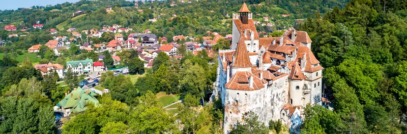
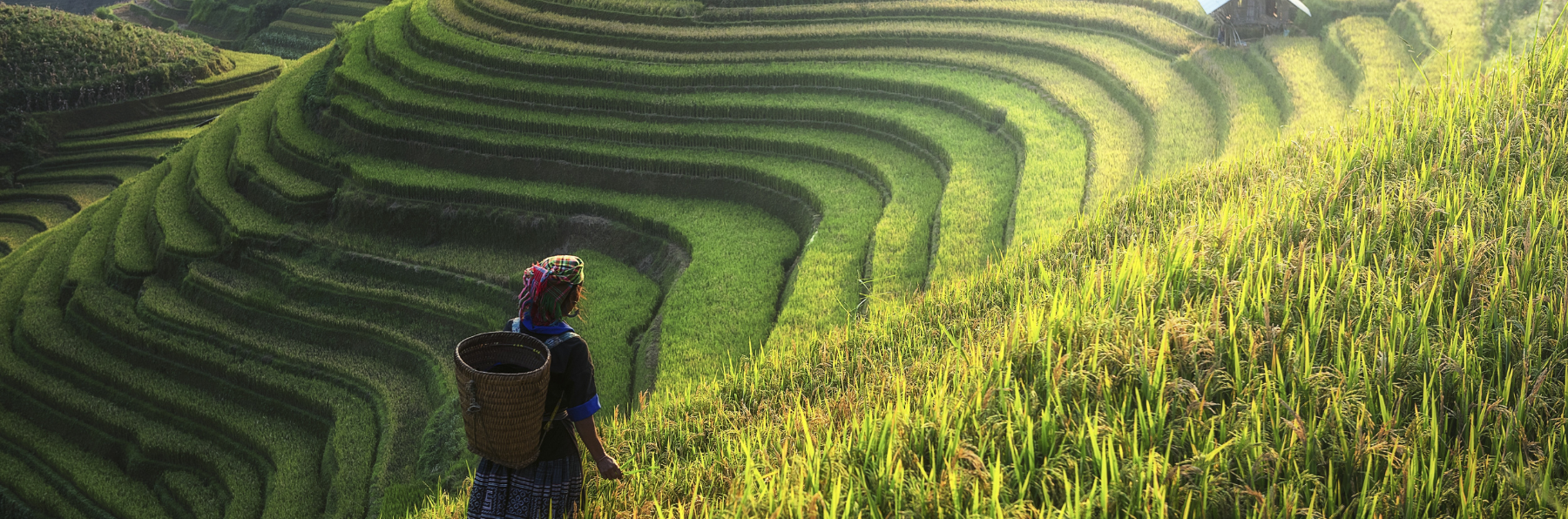
There is the Sierra, the Andean backbone that runs north to south through the country’s centre. This is not merely a mountain range. It is a double corridor of volcanoes — twenty major peaks above 4,000 metres, nine of them above 5,000 — arranged in two parallel chains with a high valley system between them that Alexander von Humboldt, who passed through in 1802, called the Avenue of the Volcanoes. The capital Quito sits in this valley at 2,850 metres above sea level, which makes it the second-highest capital city in the world and gives it a perpetual spring climate regardless of the month.
There is the Oriente, the Amazon basin that begins on the eastern flanks of the Andes and extends into one of the most biodiverse ecosystems on Earth. Ecuador’s slice of Amazonia is disproportionately significant: the Yasuní National Park, in the northeast, is estimated to contain more species of trees per hectare than exist in the entire continent of North America.
And there are the Galápagos Islands, 1,000 kilometres off the Pacific coast — volcanic, geologically young, and home to animals that never learned to fear humans because, until the 19th century, there were none.
The Monument at the Middle of the World
Every visitor to Quito eventually makes the pilgrimage to the Mitad del Mundo monument, 26 kilometres north of the city. Built in 1979 to mark the equatorial line as measured by a French geodesic expedition in 1736, it is an imposing 30-metre tower with a globe on top and a yellow line painted across the ground that tourists straddle for photographs.
The problem is that it’s in the wrong place. When GPS technology arrived, it revealed that the actual equatorial line runs approximately 240 metres north of the monument. The real zero-degree latitude passes through a smaller, less glamorous site nearby called Intiñan Solar Museum, where you can stand on the GPS-verified equator and watch water drain in genuinely different directions on either side of the line.
This gap between official monument and geographical reality is, in a small way, a useful metaphor for travelling in Ecuador. The country’s official narrative — the one on the postcards and the government tourism websites — is not false, but it often points at the slightly wrong spot. The more interesting version of Ecuador is usually 240 metres away from where you’re told to look.
Why Ecuador Is Underrated
The short answer is that it neighbours Peru and Colombia. Peru has Machu Picchu, the most recognised archaeological site in the western hemisphere, and a coherent national tourism narrative built around it. Colombia has spent two decades successfully rebranding itself after decades of violence, with Medellín and Cartagena now appearing on every boutique-travel shortlist. Ecuador, positioned between them, tends to be absorbed into other people’s itineraries rather than generating its own gravitational pull.
There is also a historical legacy of instability that lingers in perception longer than it does in reality. Ecuador had seven presidents between 1996 and 2007, and more recently, the security situation in some coastal provinces has genuinely deteriorated — something any honest guide needs to acknowledge. But the Sierra and the Galápagos, the destinations most travellers are there to see, remain well outside these concerns.
What Ecuador offers, at its best, is South America with the volume turned down. The Sacred Valley of Peru without the crowds. Amazon access without the multi-day river logistics. Colonial architecture that rivals Cusco’s but with a fraction of the tourist infrastructure pressed against it. And the Galápagos, which is simply unlike anywhere else.
Dollarisation and What It Means Practically
In 2000, in the middle of a financial crisis that wiped out savings accounts and devalued the sucre by 75%, Ecuador adopted the US dollar as its official currency. It remains the only country in South America that uses it, and the practical implications for travellers are worth understanding.
The good news: no currency exchange, no tracking fluctuating rates, no black market premium. What you see is what you pay. The less obvious news: Ecuador is not cheap in the way that Peru or Bolivia can be cheap, because it doesn’t have a weak currency to act as a subsidy for foreign visitors. A meal at a decent restaurant in Quito costs roughly what it costs in a provincial Spanish city. The Galápagos, which requires a separate park entry fee and mandated guide accompaniment, is genuinely expensive regardless of how you travel.
Budget travellers can still travel Ecuador economically — the hostel infrastructure is solid, intercity buses are well-developed and cheap, and the almuerzo (set lunch) culture means a two-course meal with juice costs $3-4 almost anywhere in the Sierra. But set your expectations based on European budget travel, not Southeast Asian budget travel.
The Ecuadorian Character
Generalisations about national character are always imprecise, but there are some things worth noting about the social texture you’ll encounter. Ecuadorians are generally reserved on first contact and warmer on second. The serrano (highland) character tends toward formality; the costeño (coastal) temperament toward extroversion. This is a distinction Ecuadorians themselves make constantly, and it maps onto a regional rivalry between Quito and Guayaquil that is genuinely felt — political, cultural, historical — even if it manifests mostly in gentle jokes.
Indigenous communities in the Sierra retain a strong separate identity. Around Otavalo, north of Quito, the Kichwa-speaking Otavalo people have maintained cultural continuity through centuries of colonialism and have built, through textile trade, a degree of economic independence unusual for indigenous communities in the Americas. Encountering them is one of the genuine cultural experiences of the highlands.
Organising the Trip
One week: The Galápagos, if budget allows — there is no time wasted getting there because the islands justify the cost and logistics entirely. Alternatively: Quito (two days), a day trip or overnight at a highland hacienda, Otavalo market (Saturday), and one volcanic landscape (Cotopaxi or Quilotoa crater lake). One week in Ecuador is enough to understand what the country is, not enough to understand it well.
Two weeks: Add the colonial city of Cuenca (three days is the right amount — enough to feel its particular unhurried quality), a night near Baños, and either an Amazon lodge stay in the Oriente or time on the coast. A two-week Ecuador is a satisfying trip that doesn’t feel compressed.
One month: This is when Ecuador opens up. Time to explore the northern Sierra and the craft communities around Cotacachi. Time to do the Quilotoa Loop properly on foot. Time for a week in the Amazon without rushing the acclimatisation. Time to understand that Guayaquil, which most travellers treat as a transfer point, has a waterfront and a history worth half a day.
The Volcanoes
No introduction to Ecuador is complete without saying something more about the volcanoes, because they are not merely scenery. They define the logistics of the country, the fertility of its soil (Andean volcanic soils are among the most productive on Earth), the location of its cities, and in several cases the shape of its history.
- Chimborazo 6,263 m — highest point in Ecuador, farthest from Earth's centre due to equatorial bulge
- Cotopaxi 5,897 m — one of the world's highest active volcanoes, accessible day-trip from Quito
- Tungurahua 5,023 m — "Throat of Fire", repeatedly active, visible from Baños
- Pichincha 4,784 m — overlooks Quito directly; the 1822 independence battle was fought on its slopes
Chimborazo deserves a particular note. At 6,263 metres above sea level it is not the highest mountain on Earth — Everest holds that distinction measured from sea level — but because the Earth bulges at the equator, Chimborazo’s summit is the point on the planet’s surface furthest from its centre. Which means that standing on its peak, you are technically further from the Earth’s core than any other human being can be. Humboldt attempted to climb it in 1802 and reached 5,875 metres, a world altitude record at the time, before altitude sickness stopped him.
The volcanoes are not just geological curiosities. They explain why the Pan-American Highway exists where it does, why Quito was built on an unstable hillside, and why the Andean agricultural system that fed pre-Columbian civilisations — and still sustains much of the rural Sierra — works the way it does. Understanding Ecuador starts with understanding that it is built on top of fire.
Traveller tip: Altitude is the most commonly underestimated challenge for first-time visitors. Quito at 2,850 m will feel fine until it doesn’t — typical symptoms include mild headache, disrupted sleep, and shortness of breath on stairs. Spend the first 24 hours doing very little. Cotopaxi base camp and the Quilotoa crater rim are both above 3,800 m. Chimborazo’s car park is at 4,800 m, and altitude sickness at that elevation is not trivial. Coca tea (mate de coca) is widely available and genuinely helps.